| The National Weather Service is forecasting a heat wave, with the added potential for showers and thunderstorms that may produce locally heavy rain and damaging wind.
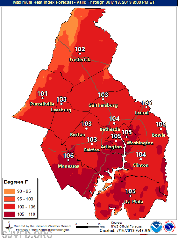
A warm front will lift north of the area today, resulting in increasing heat and humidity; heat index values of 100 to 105 are likely Wednesday, and are possible Thursday.
The remnants of Tropical Cyclone Barry will bring increasing moisture Wednesday and Thursday. This increasing moisture may fuel thunderstorms capable of producing a few damaging wind gusts or isolated instances of flooding, particularly Wednesday afternoon and evening.
Dangerous heat and humidity are becoming increasingly likely for Friday through Sunday. Heat indices around 105 to 115 degrees are possible each afternoon and early evening. Heat indices may hold in the 80s and 90s at night (especially near and east of Interstate 95). If the prolonged heat and humidity are realized, it will become a significant threat to anyone exposed to the heat for an extended period of time.
Emergency Management will continue to monitor forecast conditions and is evaluating the need for a coordination call with human services, public health, and public safety partners. We will also be coordinating public messaging with County Communications. |